2024 09 Canada GDT Last Leg as told by Brent Wray
- Peter van der Gugten
- Nov 6, 2024
- 35 min read
Updated: Nov 16, 2024

GDT Completion / Best of Banff Adventure - September 2024
Prologue – The story of how what happened came to happen, and how what happened before what happened happened almost caused what happened, to not happen.
Aug-Sep 2022: I join Peter and Tina, as their #3, in an attempt to ride an equestrian version of the Great Divide Trail from Grande Cache to Waterton. Over 28 days, we make it as far as the Elk Valley, approximately 750km, before making the decision to call it quits.
Jul 2023: My friends, Jody and Angela, and I, attempt our first major, self-guided pack trip with our own critters, gear and skills: a Best of Banff tour covering 230km over 12 days. Due to some misadventures involving temporarily lost horses and a navigational error, we decide to take a pre-planned, alternate exit route and make it a 9-day, 150km tour.
Sep 2023: Peter brings a group of European clients over to do a multi-day adventure on the South Boundary Trail in Jasper National Park, with the assistance and horses of a local outfitter. Clients return home, calling it the “trip of a lifetime!”
Dec 2023: Peter is planning to bring another group of European clients over in the first part of September 2024 for a 10-12 horseback tour through Jasper National Park. After that, was I free to join him, and a friend from Switzerland, to do a ride somewhere in the last half of September? No specific plans at this point, but if I had any Bucket List ideas, they were interested.
Absolutely! My Banff tour idea that we’d attempted in 2023, but failed to fully complete, would be perfect for such an adventure; I’d love to give it another try! With a couple more tweaks of that planned route to make it even better, we ended up with a slightly enhanced version of the trip mentioned in Tania Millen’s book, “Pack Em Up, Ride Em Out” – a 13-day tour, covering 300km through some of the most spectacular country that Banff National Park has to offer.
Feb 2024: Peter’s Jasper plans fall through. The outfitter who was to provide horses for the trip is unable to confirm the September dates. Instead, Peter will bring his two horses up from Colorado. Would I be interested in completing the Great Divide Trail ride, starting in the Elk Valley, where we finished in 2022, and riding the final 285km south to Waterton. Oh, and by the way, one of the ladies from Europe who was to go on the Jasper trip might want to come with us. He needed to check her out a bit more, first.
Wow! September 2024 was going to be amazing! If Peter and I successfully complete both these trips, as planned, together we’ll have ridden the equestrian route of the Great Divide Trail from Grande Cache to Waterton! Even more significant, since he rode the northern section from Kakwa to Grande Cache on his 2014 Rocky Mountain Explorer trail, Peter would be the first person to have successfully ridden the entire equestrian route of the Great Divide Trail!
April 13, 2024. A sudden and abrupt change in plans as I break my leg very badly coming off my friend’s recently purchased Percheron mule – a supposedly safe, sane, experienced mountain trail mule who had a vigorous and violent objection to me asking her to turn left, away from her buddies. One exciting ambulance ride, four hours of emergency surgery and a 3 day hospital stay later, the surgeon tells me it’ll be 12 weeks before I’ll be able to start bearing weight and begin rehabilitative physiotherapy. Whatever plans I have for the balance of Spring and Summer – cancel them. Dammit!
May 5, 2024. My birthday. Peter posts a birthday wish on my FaceBook page, “Hey, Happy Birthday to the Phoenix of Canada. Get well soon and have a happy day…”.
The Phoenix… I like that. Maybe, just maybe, like the Phoenix, I can rise from the ashes of this broken leg fiasco and salvage a portion of my planned 2024 adventures. Maybe, just maybe, 2024 would not be defined by my broken leg, but by doing something epic in spite of the broken leg. A seed was planted…
May 28, 2024. My first post-surgery checkup with the surgeon. She can’t believe it; my leg is healing incredibly well. I’m easily six weeks ahead of schedule in my recovery. She gives me the green light to begin weight bearing (which I’d kinda already been fooling around with anyway) and start physio. And NO, I can’t start riding horses! She’d reassess at my next checkup at the end of June. I book my first physio appointment on the way home.
So began a relentless summer journey of pushing the envelope, trying to rebuild strength, flexibility, range of motion and stamina in my leg, without overdoing it. I’d go to be bed every night with my legs aching from the knees down; wake up in the morning, refreshed, and get back at it again.
Three days after the checkup with the surgeon, I picked up my dog from my friend, who had taken him into her home and family, caring for him as if he was their own. It was time to get my buddy boy back; our daily dog walks would be additional physical therapy.
June 26, 2024 – 10-week checkup with the surgeon. Excellent progress, she still can’t believe it. There’s nothing more she can do. Keep doing what I’m doing. She turns me loose. Yes, I can start riding my horse.
July 2, 2024 – With an oversized stirrup that fit my air cast, donated by a friend, I ride my horse for the first time in 11 weeks and one week earlier than the original prognosis of being able to actually start weight bearing. I begin conditioning my horse in the arena and on short, local trail rides.
August 3, 2024 – I’m finally able to get my left foot into a hiking boot. I celebrate by going for my first horseback ride with my regular stirrup and no air cast. I up the ante and start doing longer, more challenging, conditioning rides.
August 30, 2024 – I hook up the Adventure Rig, load my horse and gear, and hit the road to meet Peter for our September Adventures, just like we planned. We meet in Syncline Equestrian Camp in Castle Provincial Park in Southern Alberta, where we organize gear & groceries. I whip into Blairmore for a final grocery shopping trip, while Peter does other preparations. After a glamping steak dinner cooked on the BBQ, we hit the sack.
August 31, 2024 – With gear and groceries allocated across the various horn, saddle and cantle bags, we saddle and load horses, doing a dry run to ensure all is good for our first week on the trail. It is. Peter heads to Calgary to pick up Barb, who is flying in from Vienna, Austria; I putter, caring for horses, gear and camp, then prepping dinner for when Peter and Barb get back.
It’s a strange thing, meeting someone for the very first time and knowing you’re going to be spending nearly every waking moment: riding, eating and sleeping, with a complete stranger 24/7 for the next two weeks. You say a silent prayer to the Gods hoping they won’t drive you nuts and all will be OK. Peter returns with Barb and introduces us. A warm welcome and big hug; I can’t believe she isn’t jet lagged after her long, exhausting flight. The three of us enjoy conversation, laughs and shared excitement about our upcoming adventure over a steak dinner with potatoes & veggies cooked hobo-style, in aluminum foil, on my little portable barbecue.
Tomorrow we would start the first leg of our adventure, a relentless, up & down, 143km, 7-day traverse of the Eastern Slopes of the Rocky Mountains from Aldridge Creek trailhead in the Elk Valley to Atlas Staging Area north of Coleman.
I go to bed confident about three things: Peter, Barb and my horse, the Buckskin Wonder, but I’m still not sure if my gimpy leg and I will be able to pull this thing off. Regardless, I’ve prepared as best I can; I’m fully committed and going for it 100%. Bruce Willis said it best in Die Hard, my all-time favourite Christmas movie, “Yippee Ki-Yay M*****F*****!”
GDT Completion: Day 1
Up bright & early, we got a good start on the day. First things, first, so we hit the Tim Horton’s in Blairmore, just for Barb. I mean it’s her first full day in Canada, may as well start it off with some Timmie’s. Then it was back on the road to drop my rig at Atlas, as our pickup vehicle.
When planning all this, I used Google Maps to determine driving routes between various areas and trailheads. Google Maps recommended routes got me into trouble twice before we even unloaded the horses.
The first one, was the best route from Coleman to Aldridge Creek trailhead. Google recommended a route via Fording River Road, past a couple of coal mines on some sketchy looking Forest Service Roads, then enduring a steep 12-switchback descent down the mountain to Kananaskis Power Line Road and north to the trailhead.
The idea of going down those switchbacks with a truck, trailer, 3 horses and pile of gear just didn’t seem like a good idea to me, so I reached out to my friend Bill, a long-time backcountry horseman, hunter and conservationist who was very familiar with the area.
“Oh no! Don’t go that way. That’s nuts!” and he recommended a slightly longer, but much better route to the trailhead.
Whew! I’m glad I questioned Google’s recommendation and reached out to him.
I wasn’t so lucky on Google’s other recommendation. After driving north from Coleman to McGillivray Staging Area, I asked a camping ATV’er if this was the road to Atlas.
“Yup, but you won’t get through with that rig”, he responded dryly. “Ditch the trailer and you MIGHT make it with just the truck. Your best bet is to go back to Coleman and take the direct route north from the highway to Atlas.”
So, that’s what we did. At Atlas, we found a suitable spot to park my rig, then I piled into the back seat of Peter’s truck and we headed back to the highway. From there, we headed west, crossing the border from Alberta into British Columbia, then turned north at Sparwood towards Elkford. After Elkford, it was a slow, 2-hour, bumpy grind up the Elk River Forest Service Road to the turnoff Bill had recommended and then doubling back to Aldridge Creek trailhead.
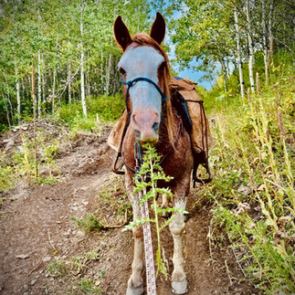
We unloaded the horses, saddled and packed gear and were ready to go by 1:00pm, 2 hours later than planned, but sure felt good to finally be on the trail. Peter is riding Rodeo, a Kentucky mustang; Barb is riding Peter’s other horse, Ahi, a criollo from Argentina; I’m riding Charlie, a morgan, also known as The Buckskin Wonder.
We had a bit of a scare, shortly after hitting the trail. It was the first of several crossings of Aldridge Creek. I led the way and as Charlie was climbing up out of the creek, a portion of the bank gave way beneath him and he went down. He tried to get up, but couldn’t with my weight on top and his legs snarled up in now exposed tree routes. With a quick wish and a prayer, I bailed off as quickly as I could. Fortunately, I landed OK and without my weight, Charlie was able to regain his footing and scramble up the bank. Peter and Barb’s crossing were uneventful, so I climbed back on and we continued down the trail.
After that, we encountered a spot where a landslide had decimated the trail. It looked like there was an alternate route going back up the mountain. We thought maybe it would go up, across the top of the landslide, then back down to the river. After climbing more than seemed reasonable, we decided to head back town to the creek and just grind our way upstream until we connected back into the trail. Our logic being the trail had to cross the stream eventually as it made its way east towards Fording Pass.
Sure enough, we reconnected with the trail and from then on, it was decent trail, but quite steep in places as we worked our way up to Fording Pass and its stunning views. Lots of walking on the way down, as the trail was very steep, rocky and strewn with exposed tree roots in places.
I did OK, but it’s the downhill stretches and uneven, sketchy footing that are most challenging for me, so I was slow. We were about halfway down when Peter said, “No one would ever know you had a badly broken leg six months ago.”
I beamed, because my biggest concern going into this was that I’d be too slow on the walking sections and couldn’t keep up. “Thanks Peter, that’s great to hear, but it was actually only four and a half months ago!”
Eventually, we make it to the camp at James Lake. Camp was ok, but there was no decent spot to set up our portable electric fence corral. We hobbled the horses and allowed them to graze, while we set up camp and had dinner. I’d spent the winter down the rabbit hole of preparing homemade dehydrated dinners for our trip. Tonight’s pick was beef stroganoff, which received positive reviews after a long day on rough roads and steep trails.
All in all, a long day of travel, both on the road and on the trail. We’d ridden and walked 20km, crossing Fording Pass, elevation 2345m, in the process. It felt good to have the first day behind us. When the horses were full, we tied them to trees for the night, and rolled out our sleeping bags to sleep under the stars. This would be the first time in Barb’s life that she’d sleep under the stars.
GDT Completion: Day 2
I usually sleep very well on the trail, but not last night. I wasn’t sure if it was a busy mind, aching legs, or some combination of both, but sleep did not come easily, or well. Fortunately, I was alone in my deprivation; everyone else slept great.
We untied the horses and turned them out to graze, hobbled and belled, while we had breakfast and packed up camp. Grazing wasn’t great, but at least they’d get something in their bellies before starting the day. A mental note was made to take a healthy grazing break at the first decent patch of grass we encountered on the trail.
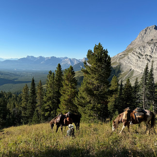
We were saddled and on the trail by 8am. Over the course of the day, we crossed three drainages: climb and descend 250m, climb and descend another 250m, then climb and descend a final 400m. Easy travel down low on wide, clear ATV and snowmobile trails. Much of the trail was in the trees while climbing and descending, so not many photo opportunities. Once we were up top though, the views are phenomenal.
After 8.5 hours on the trail, covering 21km, with a combined 900m of ups & downs across three drainages and allowing for numerous grazing breaks, we reached Lost Creek camp around 4:30pm. It was a beautiful spot near the creek, with plenty of grass. We hobbled and belled the horses and turned them loose to graze, fencing off a particularly good patch of grass with our portable electric fence for them to enjoy overnight.
Tired, stiff and sore, I took the opportunity to have a good stretching session and soaked my aching leg in the creek. Everyone enjoyed a refreshing wash/swim in the creek. DIY dehydrated lasagna with fresh grated parmesan cheese for dinner. Clear skies, so Peter and I slept under the stars again, while Barb tried out her new bivy bag. I was hopeful for a good night’s sleep, because tomorrow was a big day: the longest planned distance of this 7-day stretch.
Day 3: GDT Completion
Ahhh… That’s more like it. A great sleep had me waking rejuvenated and ready to tackle the longest planned distance of this 7-day stretch traversing the eastern slopes of the Rockies. Everyone was else was refreshed and ready to go, too. Judging from the amount of mowed grass, the horses had taken advantage of the freedom to feast and they, too, were recharged and ready to tackle the day.
The day started off with a big 350m climb, from 1850m elevation to 2200m, over the first 4km, which then undulated between 2200m and 2280m for the next 11km. We enjoyed excellent trail and spectacular views under a bluebird sky. We then descended to 2000m for a bit, before another climb back to 2200m elevation. That’s when things got interesting.
We’d travelled 25km and planned to camp at Soda Creek. The problem was we couldn’t find the camp spot and the creek was dry. Peter scouted on foot, while Barb and I stayed with the horses. We were in the Beehive Natural Area, at the base of Beehive Mountain; Peter followed a trail that went east, down the mountain, to the Oldman River Road in the valley below. Ideally, he’d find a great place to camp with grazing and water.
The horses grazed and Barb and I had a great visit, getting to know one another, while he was gone. Eventually, Peter came back. He’d found great grazing and a reasonable place to camp about a kilometer down the trail, but no water.
Fortunately, the horses had had a great drink at the last water source a little way back down the trail. The grass at the spot Peter had found was fresh and green, so there’d be water in that for them. They’d be ok, but we needed water for dinner tonight and breakfast in the morning. Peter took every water bottle and hydration bag we had, mounted Rodeo and headed to the last water source to get water for us. Barb and I took Ahi and Charlie and headed down the Beehive trail to the spot Peter had described.
Sure enough, we found it, just as Peter had described. We unsaddled the horses, hobbled them and turned them loose to graze. We set up the portable electric fence on the best section of grass, completely crossing the trail. If someone came up the Beehive trail that evening, or in the middle of the night, they were gonna be in for a surprise! But, the likelihood of that was low, so we did it anyway.
A nicker from the horses alerted us to Peter’s return with full water bottles. He unsaddled Rodeo, turning him out with the others. Rehydrated Spanish rice and chicken for dinner and another clear night, so we rolled out our sleeping bags in a cozy little corner for a great sleep under the stars, once again. We were tired. It’d been a big day.
All in all, a 25km day and 600m in elevation gain; add in the extra kilometer down Beehive Trail to our camp spot, we'd covered 26km in total. That said, Peter’s GPS is going to show well over 30km with all the on-foot scouting and water retrieval efforts. The man is a hiking machine. Respect!
Day 4: GDT Completion
We slept in this morning, getting up 7AM, instead of our usual 6AM. We had breakfast, packed up camp, took down the electric fence, and were saddled and on the trail by 8:30. We always start the day on foot, leading the horses; the primary reason is it allows the horses to get the blood flowing and warm up their muscles without having to haul our butts around. Selfishly, it’s great for us, too, and on a crisp, cool September morning it’s the best way to stay warm.
We made our way back up Beehive Trail to the GDT and turned south. After 2km of travel we encountered a small creek with a small pool for the horses to drink and flowing water from which we filled our water bottles. As expected, the horses all had a bit of drink, but nothing major. Last night’s stay at Camp No Water had been a bigger deal for us, than it had been for them.
Over the next 4km, we descended 400m to the Cache Creek drainage, then immediately started climbing again, regaining all 400m in elevation over the next 5.5km. We enjoyed a couple kilometers of ridge riding and spectacular views before dropping down into the trees and losing all 400m of elevation in our descent into the Hidden Creek drainage.
It was here we came across a wonderful, long-established horse camp with a beautiful willow meadow for the horses to graze and Hidden Creek nearby. Our original plan was to ride another 3-4km and camp at South Hidden Creek, but this camp was so perfect and after the imperfection of yesterday’s situation, we decided to call it a day and set up camp. We’d travelled 17km today.
I’m sure the horses enthusiastically agreed with our decision as we unsaddled, put on hobbles and bells and turned them loose. We were pretty pleased with our decision, as well, taking full advantage of the free time to air dry sleeping bags, still a bit damp from overnight condensation. We all made a visit to the creek for a bit of a swim, wash and freshen up. I’d tweaked the Achilles tendon on my bad leg on one of the downhill stretches, so it felt good to give it a good soak in the cold mountain water of Hidden Creek.
It had been getting progressively more overcast with a possibility of light rain overnight, so for the first time in our trip, we set up the tarp shelter. Rehydrated Creole crab corn chowder for dinner, after which we all kinda did our own thing: relaxing, catching up on trip notes and reflections, visiting with the horses, or puttering around with gear.
Tomorrow would be a challenging day as we crossed up and over Tornado Saddle. In my research, it had consistently been the most-mentioned place by hikers of Section B (Crowsnest Pass to Kananaskis), and arguably garnering Top Three mentions for the entire 1100+ kilometers of the Great Divide Trail.
GDT Completion: Day 6
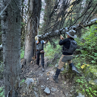
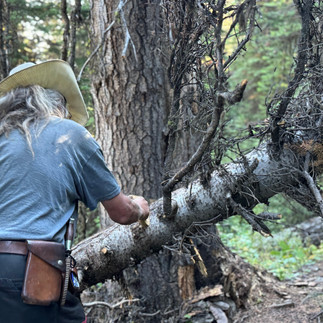
As much as I love clear skies and sleeping under the stars, it does make for cooler mornings. Today was no exception, as we awoke to a light layer of frost covering ground and gear. Packed up and on the trail early, we walked to get the blood moving and warm up. Trails were excellent, but had to haul out the pack saw twice to clear fallen logs we couldn’t bushwhack around.
We were on the new High Rock Trail, recently completed by Great Divide Trail Association volunteers and officially designated part of the GDT in 2022. It was built with hikers and equestrians in mind. Word for the day was serpentines as we crossed two drainages: serpentine up 275m, serpentine down 230, rinse, repeat: up 400m, down 265m.
We came to a great camp by a lovely stream around 2pm. We were tempted, but it was too early in the day to pack it in, so we continued. More drainages, more serpentines. Up 260m, down200m, up another 260m and down 230m. That beautiful serpentine trail made the climbs and descents much easier than they would’ve been otherwise. We all agreed the GDTA trail crew did an excellent job.
Then things got interesting. I knew from my research that horses were unable to reach Window Mountain Lake via the hiker route and had to bypass. Unfortunately, I couldn’t find the WML Bypass track on any of the GPS apps (Garmin, Gaia, Cal-Topo or Backcountry Maps), so I knew we had to bypass, but not exactly where, or what it looked like.
It was around 4pm and we came upon a sign indicating “horse route”. It looked like it dropped down below the ATV road we were on, then continued parallel before climbing back up to the road. Why drop down off the road, only to climb back up again, that didn’t make any sense. Maybe they wanted to keep horses off the ATV road to avoid horse/ATV encounters. Our horses were fine with motorized traffic, so we decided to continue up the ATV road, avoiding an unnecessary (in our minds) additional descent and ascent.
Roughly 1km up the road, the trail turned off to the left and after just over ½ km it really started to climb. It’d be really tough on the horses. We stopped and Peter hauled out his Garmin GPS to check it out. “It’s steep, and gets even steeper farther up. The other side is worse! We’ve got to go back to the horse trail. Looks like it doesn’t rejoin the road, after all.”
We backtrack to the horse trail turnoff. Sure enough, it takes a different route and doesn’t parallel the road as it first appeared to. Instead, it turns into the bush and we serpentine up and over the shoulder of the mountain, descending to a rough 4x4 road coming down from Window Mountain Lake.
By now, it’s been several hours since we’ve seen water. We’ve crossed two drainages, but every creek was dry. No springs, no puddles, nothing. The day was hot and we’d all run out of water long ago. The horses hadn’t had a big drink since the stream we left at 2pm, but at least they’d taken in a bit of moisture from the grass on grazing breaks. Still, they needed water.
Fortunately, a couple in a Jeep come down the 4x4 road just as we were discussing whether to go up the road, or down. They gave us the last of the water they had with them and recommended we head down. They had seen a couple large puddles on the way up, but if we needed fresh water, South Racehorse Creek had water farther down the road.
We thanked them for the water and the advice and started walking down the road, leading the horses. Just shy of a kilometer down the road, we reach a pullout where two dads and their sons are parked. They’re getting ready to hike up to Window Mountain Lake and camp for the weekend. The people in the Jeep had told them we were coming. They gave us their water which we gave to the thirsty horses and confirmed there were two large puddles farther down the trail. Peter went with one of the guys, who drove him down to the creek to fill all our water bottles. Barb and I continued walking with the horses until we reached the puddles, where the horses were able to drink their fill. Not ideal, but that’s the way it goes sometimes. Beggars can’t be choosers.
Peter and our Trail Angel got back with water and we headed back up the 4x4 road where there was a little clearing beside the trail. We unsaddled, hobbled and belled the horses and turned them loose to graze. There wasn’t enough of a clearing for us to set up the electric fence, so when they’d filled their bellies, we tied them to trees for the night.
Dehydrated pasta with meat sauce for dinner and exhausted, we laid out our sleeping bags for another night under the stars. It’d been a big day, much bigger than originally planned, necessitated by the dry creeks and our navigational error. All in, 32km travelled and 1200m of elevation gained, and lost, over the four drainages crossed. No wonder we are all so tired!
GDT Completion: Day 7
Up at first light, we untied the horses and turned them loose, hobbled and belled, to graze while we had breakfast and broke camp. Whatever they got wouldn’t be enough, but it’d suffice until we got to better grass for an extended grazing break. With yesterday’s greater than planned distance covered in search of water, today would be a shortie and the horses would have plenty to eat back at Syncline Camp.
Instead of heading up the 4x4 road towards Window Mountain Lake and the GDT, we rode down the 4x4 road to Allison Creek Road, then onto an ATV trail. A mere 4km from camp we were back on the GDT. By 9AM we’d found a great patch of grass, so we turned the horses loose to graze while we sat in the sunshine and enjoyed the morning view.
Back on the trail, we had one small 200m climb, before we began our 550m descent, enjoying fantastic views, over the final 11km to the truck. Charlie seemed to know we were almost done, because he was an absolute BEAST leading the way, settling into a relaxed, but ground covering, trail walk that had loose reins swinging and rhythmically keeping time. We reached the truck shortly before noon with a celebratory cheer and hugs all around. We’d made it! A 17km day.
The first leg of our GDT Completion effort (Elk Valley to Coleman) was complete. All told, we’d travelled 152km over seven days, crossing one mountain pass, one infamous saddle and more than ten drainages. Sure, there’d been a couple minor misadventures, but we’d had great weather, no injuries and no lost horses. Success!
We loaded up the horses and headed back to the Crowsnest, where we stopped in Blairmore for lunch and groceries before heading back to our base camp at Syncline. Horses relaxed in their pens with a steady supply of hay while we cleaned up, repaired gear and cooked dinner. Today was Barb’s birthday so we celebrated with a big feast, frosty adult beverages, birthday cake and the melodious tones of Peter and I singing Happy Birthday.
GDT Completion: Day 8
Today was a rest day for the horses, but a big day in terms of logistics as we wrapped up Leg 1 and set up for Leg 2. Barb stayed at Syncline to care for the horses, clean gear, replenish food and supplies and basically get us prepped for Leg 2. Peter and I were on the road early, driving back up to Aldridge Creek trailhead to get his truck and trailer, then driving all the way down to Waterton National Park to drop his rig off at Rowe Lakes trailhead as the pickup vehicle at the end of our next riding stretch.
We stopped in at Alpine Stables on the way back to check in and confirm our dates for horse accommodations. One of our big concerns was when we’d arrive at the end of our riding stretch, we weren’t sure if we could be there before they closed. Jenika quickly eliminated our fears, “Don’t worry about it, I’ll be here. Ride safe, get here when you get here and we’ll make sure you’re taken care of.”
Alpine Stables in Waterton – such a fantastic multi-generational, family-owned business. They’ve been great and incredibly easy to deal with on all our adventures. We can’t say enough good things about them. Check out the link to their website in the comments.
Back on the road to Syncline Equestrian Camp, where we enjoyed another big, glamping dinner and a little R&R before hitting the sack. All in all, a big day on the road, travelling more than 500km, with about 100km of that on rough Forest Service Roads, shuffling vehicles around.
This next leg was going to be very different from the first. We’d start with a 2-3-day ride into Waterton National Park to our waiting pickup vehicle, but because Waterton was super-stingy with equestrian camping permits and didn’t allow horses on the roads, we’d have to do a lot of shuttling and day rides, with Alpine Stables as a base for the horses. After getting the Waterton sections rode, we’d come back to Syncline and finish off Section A of the GDT, riding the final Coleman to Lynx Creek stretch. Definitely more challenging logistically, but we’d figured it out and had our game plan. We were ready and excited for the next leg of our adventure.
GDT Completion: Day 9
It was today’s stretch on the ride over to Waterton that had been giving me the most angst. The hiker route of this portion of the GDT goes over La Coulette ridge. It is considered the toughest section of the entire 1100+km of the GDT: barren, rocky, steep, sketchy trail sections and no water. No question, it beats people up. Yet, it was included in the equine route of the GDT that I’d been sent in 2022. It’d been nagging at me; if this is so tough on people, is it even possible on a horse?
I reached out to Tania, who’d sent me the equine GDT route and asked her if she’d ridden it. She hadn’t, but gave me a couple names of people who’d know. One of them, Joyce, was a mutual FB friend, so I reached out to her, via FB Messenger, in hopes of gathering better intel.
“La Coulotte?! Oh no! You can’t do that on a horse!”
OK, my fears were confirmed. She began describing a La Coulotte equestrian bypass route. While she was doing that I was pouring over Gaia GPS and Backcountry Maps trails trying to find the trails that matched what she was describing. I cobbled a route together and sent a screenshot to her. “Yup, that’s it!” she replied.
She gave me a bit more intel describing the trailhead and where to park, as well as sending some photos from her trip via the same route many years ago. It looked pretty spectacular! At the same time, I had a brain wave that things might work better for us if we didn’t ride the route in sequence, instead riding individual sections in somewhat of a leapfrog strategy. So, with less than a week to go, I reworked the entire plan for the Coleman to Waterton stretch of our ride.
OK, enough backstory. It was a short drive from our camp at Syncline to the South Castle trailhead. We were unloaded, saddled and on the trail by 8AM. Easy riding on an old Forest Service Road and ATV trail down the river valley. The rest day had been good for the horses; they were fresh, stepping out and seemed happy to be back on the trail. We’d covered 23km, reaching the turnoff where we’d start climbing Font Mountain to reconnect with the GDT, so we stopped for lunch and an extended grazing break.
It was shortly after lunch that our easy day got interesting. We lost the trail up Font. Peter dismounted and scouted on foot – couldn’t find it. We backtracked, tried again and lost the trail again. Peter scouted, on foot, again; couldn’t find the trail. He said according to the GPS, he crossed the trail three times, but there was absolutely nothing that looked trail-ish. Now, Peter’s no rookie when it comes to route finding and difficult trails; he’s got 20 years and many tens of thousands of mountain trail miles travelled under his belt. I’m not about to question him. If there had been a trail, it had been decimated by avalanche, landslide or years of inactivity – deadfall and logs everywhere.
We decided to climb to try and get above the debris, then cross over to see if we could intersect the trail. We climbed and then bushwhacked through the tightest forest I’ve ever been through. In one tight spot, my pack saw snagged on a tree and ripped right off the saddle as Charlie went through. Another spot claimed a saddle bag, requiring impromptu, trailside repairs to fix a pre-determined fail-point, which saved the bags from much more significant damage. I said a heartfelt THANK YOU to Daniel Suchefort for his exceptional design and craftsmanship in making my bags for me. Normal bags would have been shredded on that trip through the trees.
We made it through the trees and continued climbing. It was steep, getting steeper. Barb was leading the way, followed by Peter, then myself. Charlie was doing something I’d never seen him do, flexing at the knees and pointing his front hooves to get better bite into the terrain with his tippy toes, then catching up with his hindquarters, enabling his front end to leap up, once again, and get another toe hold. We’d progress, maybe three leaps at a time, before stopping to rest again. We were trying to serpentine, but our space was limited and narrow.
After the most grueling uphill grind I’ve ever endure, much less done with a horse in tow, we started looking for a route across. We knew the trail was off to our left, but couldn’t see a way across the deeply cut Spring runoff drainages. We knew the trail went up a notch in the headwall to gain access to the top and intersect the GDT. We looked at the sheer rock headwall ahead of us. There was no way through.
After a rest break and catching our breath, Peter said, “I have an unconventional idea.”
“What’s that?” Barb, and I, asked in unison.
“We give up. We go back down the mountain and camp at that last camp we saw. We’re tired. The horses are tired. We can’t find the way and if we keep trying, one of us is going to get hurt.”
Up until that point, not one of us had thought of quitting. We were determined to figure this out and find a way, but as soon as Peter raised the idea, we knew he was right. It wasn’t worth injury to ourselves, or our horses. We unanimously agreed and started working our way back down. What had been the toughest uphill climb I’ve ever done, now became the toughest descent. The horses were absolutely amazing in how calm, trusting and sure-footed they were.
Slowly, but surely, we worked our way back down the mountain, then retreated to an old horse camp where we set up camp for the night. Undeterred, we decided we would go back to the trailhead, load up and head over to Waterton, where we would rejig our plans and reverse engineer our trail from that side.
Peter’s GPS showed 40.3km travelled today, but he did a pile of scouting, on foot. Scouting aside, my GPS track showed a 33km day. Yup, Peter did a LOT of scouting trying to find that trail.
One of my most unusual dehydrated meals for dinner tonight, Mulligatawny Stew. Barb says it’s been her favourite, so far. Beaten for today, but not defeated, we go to sleep under the stars, to begin again tomorrow.
GDT Completion: Day 10
Up early and on the trail by 8AM with no lingering physical effects of the previous day’s mountain climbing adventure. With the benefit of a good night’s sleep and a refreshed perspective, we were even more unanimous in that we had made the right call in turning back. Our minds had turned from disappointment to renewed excitement about how me might salvage as much of the trail as possible, from the other side.
We made good time on the familiar, easy trail (23km) and were back at the truck, loaded and on the road by shortly after Noon. Jenika was surprised to see us when we arrived at Alpine Stables. She was even more surprised to hear of the difficulty we’d had on the Font Mountain trail; she’d ridden it successfully just 3 years prior.
We got the horses set up in their pen with lots of feed and met Jen in the office where we gathered around the big map of Waterton National Park, and all its trails, hung on the wall. She showed us a route starting at Rowe Lakes trailhead, our original planned ending point, following as much of our planned ride as possible, then turning and following a valley to Red Rock Canyon.
“This is a great ride that allows you to cover as much of your original plan, as possible, without any duplication. It’s a big ride and a long day, but you guys are used to that.”
Great! That’s what we’ll do. We left my trailer at Alpine and went up to Rowe Lakes trailhead to retrieve Peter’s rig, which we then moved to our new pickup spot at Red Rock Canyon. On the way back down the canyon road we stopped to watch a momma bear and her two cubs feeding near the side of the road.
Next stop, Waterton campground, where we checked in, found our camp site and headed to the shower house to clean up. That hot water shower sure felt good after a week-and-half of bathing in cold mountain streams, if anything at all. Our previous streamside cleanup had been 5 days prior, at Barb’s Cowboy Camp, so yeah, we were due.
Then it was off to Zum’s Eatery where we had dinner with Jenika and Phillip, a fellow from Switzerland, travelling the America’s with his wife and 2 young daughters. His wife had gone back home to deal with some family matters, so he was alone with the girls, for now. A super-intelligent, interesting guy living an unconventional lifestyle. A chemist by trade, cyclist and adventurer by recreation, he’d travelled the world. The young girls were fluent in at least two languages (Swiss and English) and getting an education, life experience and global perspective substantially beyond that of typical adults.
Peter, Barb and Jen are all well-travelled, with many adventures, as well. A great time was had over good food, cold beers, great conversation and many stories. We shut the restaurant down, said our goodbyes and walked back to the campground, where we rolled out our sleeping bags and slept under the stars. Our minimalist style gave us all a chuckle in a campground with all sorts of camping setups, including a few unbelievably large, expensive motorhomes.
GDT Completion: Day 11
Today’s planned ride had all the ingredients for epic: distance, elevation change, challenge, scenery and views. Little did I know it would turn out to be all that, and more!
The folks at Alpine fed the horses for us that morning, so they were finished breakfast and ready to go when we showed up. Quick trip up to Rowe Lakes trailhead and we were ready to hit the trail by 9AM. It was great to see another rig in the horse trailer parking area: Doc Jones and his buddy, a professor from a University in Utah, were riding to Rowe Lakes today. Doc was a retired local veterinarian and at 90-years-old, was still getting out and riding regularly in the mountains. Aspirational goals!
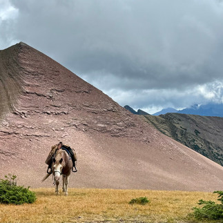
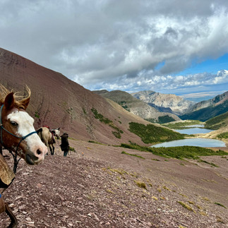
We began climbing right away, riding with Doc and the professor as far as the Rowe Lakes turnoff. Boy, could that bay mare of his ever step out and walk! She was all business. We had a great chat at the turnoff, then they went left to Rowe Lakes and we turned right, resuming our climb up and across Lineham Ridge. We walked, tailing the horses, as the rocky trail traversed the barren slope in a wide serpentine. One final climb and we were up on top. We’d gained 955m in elevation over 8.2km, at a steady 10-15% grade. The view was absolutely breathtaking in all directions.
From here, we traversed the ridge, then started down Tamarack trail to the valley below, where we stopped for lunch and a grazing break. From there, we continued down Tamarack to Lone Lake. There’s a ranger cabin there, with corrals, and it’d be a great place for a halfway stay on a pack trip, but WNP is goofy about giving equestrian camping permits, for some reason. I’ve tried twice, in 2022 and 2024, and both times the recommendation was to camp outside the park. They definitely aren’t as equestrian friendly as Banff or Jasper. That said, they’ve got some great horse trails and designated horse trailer parking; it’s just the camping that seems actively discouraged.
Anyway, I digress. We continued down Tamarack, to the Twin Lakes trail turnoff. Up until this point we’d been on our GDT completion route. If we’d continued on Tamarack, past Twin Lakes, we would leave WNP and cross Sage Pass to Font Mountain, which is where we ran into trail difficulty two days prior. I’d still like to ride that route and see if I could reverse-engineer the Font Mountain trail. We’ll see if any hardy adventurers want to tackle it with me someday.
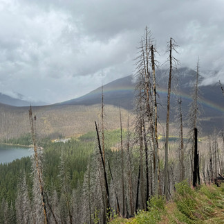
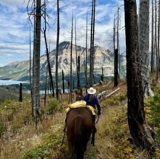
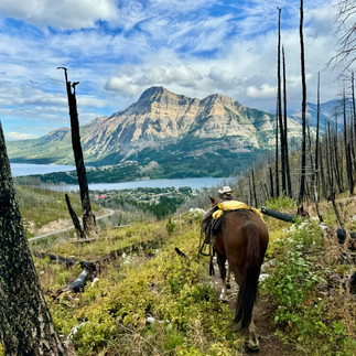
Our new trail took us east, down Blakiston Valley to Red Rock Canyon. It was a gentle descent through the remains of the massive 2017 Kenow fire (see link in comments), which burned a total of 350 square kilometers and nearly 40% of Waterton National Park. A group of wildfire fighters had been left on the peninsula to protect the historic Prince of Wales hotel, their only escape route being into Waterton Lake. Somehow, they managed to hold off the fire and save the hotel. Sadly, today was the sobering anniversary of Alpine Stables losing their original structures in the fire.
Often, when going through an old burn, it can be like traversing a game of Pick Up Sticks, with all the old, dead, fallen trees across the trail. Gotta give credit where credit is due though, WNP had done a fantastic job keeping trails clear; we didn’t encounter one tree across the trail. Views were stark, but great, through the burn, with tons of new growth. All that new life in the shadow of all that death; it was surreal.
The colours down Red Rock Canyon were deep, rich and vibrant, as we reached the end of our trail at the highway. We were a little ways up the road from Peter’s rig, so rode the road down. We must’ve been quite a sight for the few vehicles on the road, judging from all the smiling faces and picture taking as vehicles slowly passed us. The horses were unfazed by the vehicles, or their short-lived celebrity status.
All in all, a 31km day with a nearly a kilometer of elevation gained, and lost, in 8.25 hours on the trail. It was then that our already epic day went completely off the charts.
First, the backstory. On the way back from picking Barb up at the airport, they stopped in at Frontier Western Shop in Claresholm to pick up some things Peter needed. Somehow, they got chatting with this fellow and told him about our planned adventure. He lived in the Pincher Creek, Waterton area and gave them his phone number saying, “If you guys have time while you’re down that way, give me a call. It’d be great to get together and hear about your trip.” So, we called him yesterday on our way to Waterton and were invited out to their place for dinner and a visit after our ride.
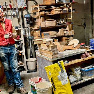
After dropping the horses off at Alpine Stables, we headed out to Glenn's place. Glenn, and his wife, Jan, were fantastic hosts and super-interesting. He was an old cowboy, who for a time was a key player importing high quality Quarter Horses into Germany. After that, he got into making high-end saddle trees for western saddles and is one of, if not THE best saddle tree maker in North America. Each saddle is custom made for the rider, horse body type and the nature of riding done. Saddles are not custom fit to individual horses, because horse’s back can change from season to season, depending on conditioning and degree of work done. Additionally, the body changes over a horse’s life span, too, so his trees are made to fit a wide number of horses of a particular body type. He gave us a tour of his workshop, showing us everything from selecting raw materials for the saddle, the process and various stages of saddle tree making. Absolutely fascinating! Forget about getting one of his trees though, he only works with a select group of the best saddle makers in the West and there’s a 2-year waiting list for his trees.
Jan cooked a fantastic beef rib dinner and over the course of dinner and many hours afterwards we had great conversation, story-telling and much laughter. Turns out we know some of the same people. Bill is the fellow who told me the best way into Aldridge Creek trailhead. They’ve known each other a long time. Bill supplies Glenn with some of his tree materials from time-to time and rides a saddle built on one of Glenn’s trees. He’s also one of the three hunters who discovered the Canadian Ice Man (Kwäday Dän Ts'ìnchi) back in 1999 (see link in comments). I’d recently attended Bill’s 25th Anniversary presentation of the incredible story at the Rossland Museum, so between Glenn and I, we told the story to Peter and Barb. We did ok, but its WAY better when Bill tells it.
To make a small world even smaller, it turns out Glenn also knows Franco, the innovative South African saddle maker (see link in comments), now living in the Kootenay’s, who made my saddle, custom fit to my scrawny ass and Charlie’s back, for the 2022 Great Divide Trail ride. Turns out they spent quite a bit of time together back in the day, with Glenn sharing his tree making experience and wisdom.
It was after midnight and well past our usual bed times when we called it a night. Peter and Barb rolled out their sleeping bags in the house, while I stayed in the small living quarters in my trailer. What an incredible day!!
GDT Completion: Day 12
Another great visit with Glenn and Jan over a fantastic breakfast, then off to Waterton. Today was cold and rainy, so we were taking a zero day and doing the Waterton tourist thing. Rest day for the ponies.
That evening we met Glenn and Jan at our favourite little restaurant for dinner. Twin Butte General Store and Mexican Restaurant is pretty much smack-dab in the middle of nowhere, but has great food and tremendous atmosphere. With a live country band playing and nothing but rodeo on all the TV’s, it really doesn’t get any more southern Alberta ranch lifestyle authentic, than that.
Back to Glenn and Jan’s for more great conversation, story-telling and laughter around the kitchen table, we shut it down around midnight and hit the sack. We’d be riding the Carthew-Alderson trail tomorrow.
GDT Completion: Day 13
Up early for breakfast with Glenn and Jan, then off to Alpine Stables to get Peter’s rig and the horses. We dropped my rig off at the far side of Waterton, where our trail would end, then drove up to Cameron Lake, where we’d begin our journey.
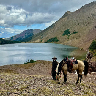
Weather was cold, windy and rainy, the worst we’d had in all our days on the trail so far. Big climb up the mountain on a series of switchbacks with great views of Cameron Lake through the burnt-out remnants of the Kenow fire. After gaining 700m over 8km, we achieved peak altitude for the day, stopping for lunch and a grazing break while enjoying the spectacular view of Carthew Lakes.
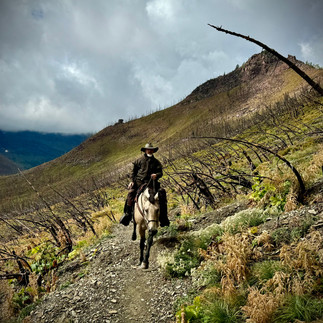
From there, it was a long 1060m descent over the final 11km. There was one spot a couple kilometers from the end where I was in the lead and encountered three young guys taking some photos near a creek. They didn’t see me coming, so I hollered “Hello” They turned and one guy exclaimed, “WHOA! It’s a COWBOY!!” I guess I really looked the part with my big hat and long oilskin rain coat, mounted on the big, bold, beautiful badass, known as the Buckskin Wonder. I chuckled to myself and thought, “not even close, fellas. I sure appreciate the sentiment, though.” Totally made my day!
We finished our journey with a short ride on the paved streets of Waterton, unsaddling on the grassy edge of the Waterton campground, then loaded up, retrieved Peter’s rig from Cameron Lake trailhead and headed back to Syncline. Peter cooked BBQ pork asado for dinner. Later that evening, some range cows invaded the camp area, so I hopped up on Charlie, bareback, and together we herded the intruders out of camp. It’d been a few years since we moved cows together, but he was all business and we got it done lickety-split. We may not be total cowboy, but cowboy enough.
Another fantastic day. We hit the sack for another good night’s sleep. Tomorrow would be our final ride on this section: Coleman to Lynx Creek, and our GDT completion attempt would become GDT completed.
GDT Completion: Day 14
Morning dawned cold, windy and rainy. Our plans hit an immediate speed bump for the day when my planned backroad driving route to drop off Peter’s rig as our pickup vehicle ran into a closed, and locked, gate. Dammit! The gate was open when we’d left for Waterton, just a few days earlier.
Farther up the highway, we came to another range road that went across to where we needed to drop off our pickup vehicle. A sign cautioned us that the road was unmaintained and full of tight turns and steep hills. Use at our own risk. With fingers crossed and a little prayer, we carried on with our two big rigs. It was slow going, but we made it to our planned spot and left Peter’s rig. Then, it was back onto the range road, only instead of turning east the way we’d came, we continued north to Coleman.
On the way, we went through a spot with over a hundred trucks and trailers with all sorts of ATV’s: quads, side-by-sides, dirt bikes and that sort of thing. It was the local ATV Club’s end of season ride and party. We hoped we wouldn’t have to be dealing with a pile of ATV’s roaring around all day and possibly spooking the horses. Our horses were good with motorized, offroad vehicles, but things can get awful Western in a hurry if something comes rip-roaring down the trail and catches you in a bad spot. We’d have to be proactive and careful.
We made it to York Creek staging area and hit the trail. Nothing too exciting trail-wise, we just ground along a series of ATV trails. Good thing we had our planned route on the GPS; it would’ve been easy to get lost, there were so many trails. I can see why this area was an ATV enthusiast’s playground.
With all the rain over the past couple days, the trail was very muddy and slick in some places. The trail was very rutted from the ATV traffic. Our horses wanted to stay on the high parts of the trail, out of the sloppy ruts, but the footing wasn’t great and there was constant danger of them slipping down into the ruts. We had to be careful. It was often easier to just keep the horses in the ruts, but they didn’t like it.
Eventually, we climbed up onto Willoughby Ridge. We encountered a few ATV’s but no scary moments and all the riders were friendly, courteous and respectful, stopping and turning off their machines while we passed. We rode the ridge for 14km in the cold, wind and rain. The clouds, rain and intermittent sunshine made for some great, moody views.
After climbing 550m over the first 16km to gain the high point on the ridge, we traversed it in undulating fashion for a while, then began our descent. Eventually we dropped down off the ridge, losing all the altitude gained in the final 9km as we made our way to Peter’s waiting rig. All in all, a cold, wet, windy 25km.
We unsaddled, loaded up and drove back up to York Creek to pick up my truck & trailer, then back to Syncline where Peter worked his culinary magic on the BBQ and we celebrated the completion of the second leg of our adventure. All told, we’d travelled 131km over 5 days of riding. We’d met with adversity, regrouped, pivoted and successfully completed the significant majority of our planned route, in spite of the Font Mountain setback. It may not have been perfect, but in our minds our GDT completion attempt was completed. Who knows, maybe someday I’ll go back and see if I can pick up those missing bits.
































































Comments